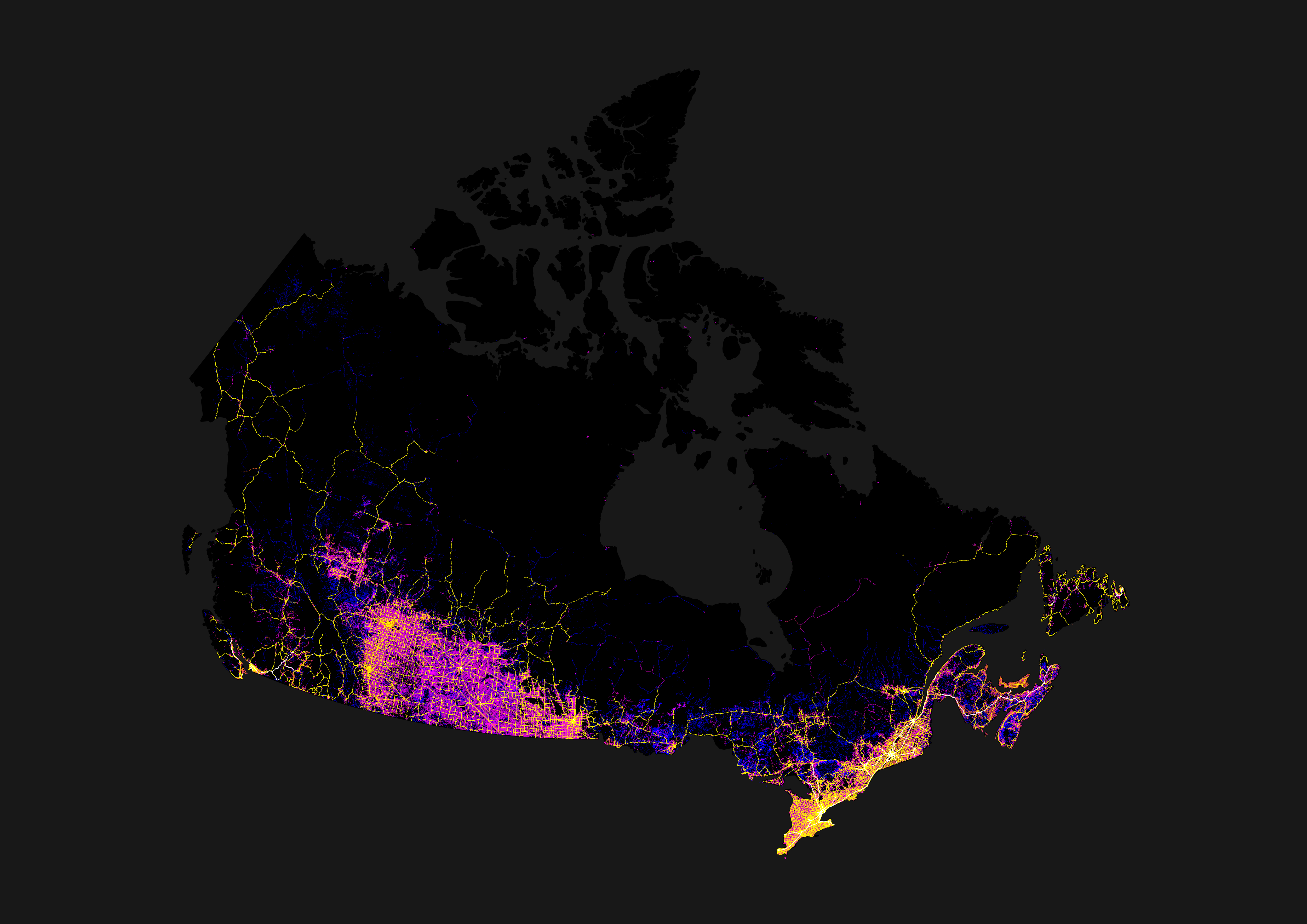
Which part? The southern prairie has ‘grid’ roads (magenta; literally roads in a grid, every mile E/W, every two N/S), with highways connecting the many towns and cities, settled because of agriculture. Then the northern shield (forest) has roads where they fit best to mainly indigenous communities.
with highways connecting the many towns and cities, settled because of agriculture.
And those towns were originally settled by farmers getting land adjacent to the railways, centered around the railway stations. They needed trains to get their produce to market, and to order their supplies from “the big city”.
Those early railroads had to build a water station about every 30 miles, as that was the distance the steam locomotives of the day could travel before needing to get more water. There were larger stations every 3rd or 4th water stop to re-supply with coal.
The history of the railroads is the history of Canada, especially so on the prairies.
If you look at Alberta and Manitoba, they also have the grid roads, but just looks more connected with a grid of highways following N/S or E/W. Saskatchewan’s highway system reminds me of nerve cells reaching out with all the angled highways spreading out from the cities.


Which part? The southern prairie has ‘grid’ roads (magenta; literally roads in a grid, every mile E/W, every two N/S), with highways connecting the many towns and cities, settled because of agriculture. Then the northern shield (forest) has roads where they fit best to mainly indigenous communities.
And those towns were originally settled by farmers getting land adjacent to the railways, centered around the railway stations. They needed trains to get their produce to market, and to order their supplies from “the big city”.
Those early railroads had to build a water station about every 30 miles, as that was the distance the steam locomotives of the day could travel before needing to get more water. There were larger stations every 3rd or 4th water stop to re-supply with coal.
The history of the railroads is the history of Canada, especially so on the prairies.
If you look at Alberta and Manitoba, they also have the grid roads, but just looks more connected with a grid of highways following N/S or E/W. Saskatchewan’s highway system reminds me of nerve cells reaching out with all the angled highways spreading out from the cities.